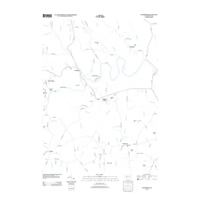
2013 Map of Cooksburg
USGS Topo · Published 2013About this map
Cooksburg serves as a central hub in this landscape, situated at a major bend in the Clarion River where it meets Toms Run. This 2013 survey illustrates the dense concentration of landmarks within Cook Forest State Park, including the Cook Tomb and the Cook Forest Tower. The area is defined by a network of winding forest roads and numerous ridges, such as Hominy Ridge and Turkey Ridge, that overlook the complex drainage system of the Clarion. Small rural settlements like Fisher, Kahletown, and Ella are connected by secondary routes like Kahletown Church Ln and Catholic Church Rd. The map provides significant detail for local historians, showing the distribution of family-named features like Gumbert Hill and Fitzgerald Hill alongside the natural hydrology of Cathers Run and Hefren Run.
Find a feature on this map
113 named features on this map. Tap any name to fly to it.
Don’t see what you’re looking for? This feature index may not catch every label — zoom into the map to look around manually.
Map Details
Editions of this 2013 Cooksburg Map
This is the sole edition of this map. No revisions or reprints were ever made.
Other maps of this area

1906 · Clarion
USGS Topo · 1:62,500

1907 · Clarion
USGS Topo · 1:62,500

1918 · Loleta
USGS Topo · 1:62,500

1922 · Tionesta
USGS Topo · 1:62,500

1924 · Tionesta
USGS Topo · 1:62,500

1924 · Brookville
USGS Topo · 1:62,500

1926 · Brookville
USGS Topo · 1:62,500

1936 · Marienville
USGS Topo · 1:48,000

1941 · Marienville
USGS Topo · 1:62,500

1944 · Brookville
USGS Topo · 1:62,500
Featured Places
- Millcreek Township, PA
- Kahletown, Eldred Township
- Cooksburg, PA
- Hottelville, Barnett Township
- Hominy Ridge, Barnett Township