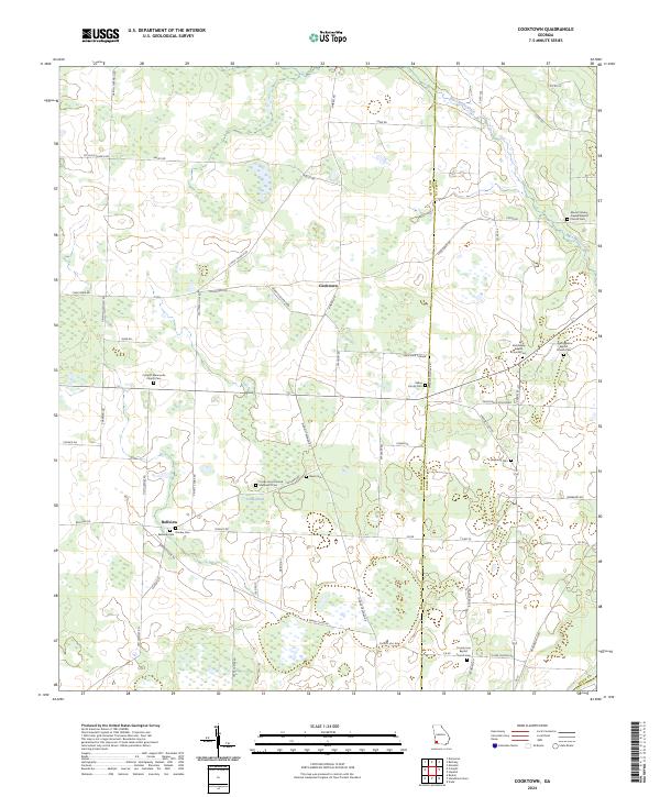
2024 Map of Cooktown
USGS Topo · Published 2024About this map
Cooktown and Bellview anchor this agricultural landscape in Southwest Georgia, situated along the border of Miller and Baker counties. This 2024 survey reveals a territory defined by small family-named landmarks and rural congregations, where the drainage of Big Cypress Creek and the waters of Cook Pond shape the terrain. The map is particularly rich for genealogical research, documenting numerous denominational burial grounds including Springfield Baptist Church Cem, Notchaway Baptist Church Cem, and the Colquitt Mennonite Church Cem. Local roads such as Griffin Sheffield Rd and Johnny Freeman Rd crisscross the fields, connecting isolated settlements like Waycaser Corner to the wider county network. Two large tracts under the Farm Service Agency Interest of Georgia indicate significant land management and conservation efforts within the agricultural belt.
Find a feature on this map
66 named features on this map. Tap any name to fly to it.
Don’t see what you’re looking for? This feature index may not catch every label — zoom into the map to look around manually.
Map Details
Editions of this 2024 Cooktown Map
This is the sole edition of this map. No revisions or reprints were ever made.
Other maps of this area

1953 · Dothan
USGS Topo · 1:250,000

1954 · Dothan
USGS Topo · 1:250,000

1955 · Dothan
USGS Topo · 1:250,000

1956 · Newton
USGS Topo · 1:62,500

1971 · Vada
USGS Topo · 1:24,000

1971 · Hopeful
USGS Topo · 1:24,000

1974 · Boykin
USGS Topo · 1:24,000

1974 · Damascus
USGS Topo · 1:24,000

1974 · Cooktown
USGS Topo · 1:24,000

1974 · Elmodel
USGS Topo · 1:24,000