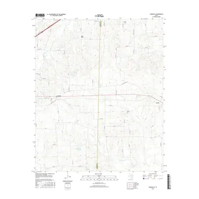
2016 Map of Cookville
USGS Topo · Published 2016About this map
The Titus Co Morris Co line divides this Northeast Texas landscape, where the settlements of Omaha and Cookville anchor a network of rural county roads and watercourses. Small-scale water features like Little Boggy Cr and Kenneth Travis Lake define the drainage patterns of the area. Local family and community history is preserved at Mount Moriah Cem and the Keith Cem, while the historic Old Mt Pleasant Hwy suggests earlier travel routes before the modern highway alignment. The geography is characterized by numerous small branches and creeks, such as Bear Cr and Sand Springs Br, which feed into larger systems like Boggy Cr. This 2016 survey reflects the persistent rural character of the region, showcasing the scattered residential clusters of Lone Star and the integration of timber and agricultural land between these small East Texas communities.
Find a feature on this map
74 named features on this map. Tap any name to fly to it.
Don’t see what you’re looking for? This feature index may not catch every label — zoom into the map to look around manually.
Map Details
Editions of this 2016 Cookville Map
This is the sole edition of this map. No revisions or reprints were ever made.
Other maps of this area

1914 · Daingerfield
USGS Topo · 1:62,500

1930 · Bassett
USGS Topo · 1:62,500

1953 · Texarkana
USGS Topo · 1:250,000

1956 · Texarkana
USGS Topo · 1:250,000

1964 · Harvard
USGS Topo · 1:24,000

1964 · Wilkinson
USGS Topo · 1:24,000

1964 · Daingerfield
USGS Topo · 1:24,000

1964 · Cason
USGS Topo · 1:24,000

1965 · Dalby Springs
USGS Topo · 1:24,000

1965 · Mount Pleasant
USGS Topo · 1:24,000