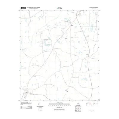
2011 Map of Coolidge
USGS Topo · Published 2011About this map
Big Creek and the Ochlockonee River define the drainage of this Georgia landscape, which remains largely shaped by rural road networks and scattered small settlements. The town of Coolidge anchors the southwest corner, while smaller communities like Murphy and Enon are identified by their respective family-named landmarks and local burial grounds, including the Murphy Cemetery and Enon Cemetery. In the northern section, the terrain is punctuated by water management and recreation at Beatles Lake and Sunset Lake.
Find a feature on this map
61 named features on this map. Tap any name to fly to it.
Don’t see what you’re looking for? This feature index may not catch every label — zoom into the map to look around manually.
Map Details
Editions of this 2011 Coolidge Map
This is the sole edition of this map. No revisions or reprints were ever made.
Other maps of this area

1953 · Waycross
USGS Topo · 1:250,000

1954 · Valdosta
USGS Topo · 1:250,000

1957 · Thomasville
USGS Topo · 1:62,500

1958 · Valdosta
USGS Topo · 1:250,000

1958 · Waycross
USGS Topo · 1:250,000

1959 · Valdosta
USGS Topo · 1:250,000

1961 · Quitman
USGS Topo · 1:62,500

1974 · Pineboro
USGS Topo · 1:24,000
1974 · Hartsfield
USGS Topo · 1:24,000
1975 · Merrillville
USGS Topo · 1:24,000