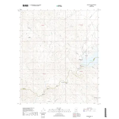
2018 Map of Coolidge Dam
USGS Topo · Published 2018About this map
Coolidge Dam stands as the central landmark in this 2018 topographic study, where the Gila River meets the San Carlos Reservoir at the boundary of Gila and Pinal counties. The landscape is defined by complex desert drainages and elevations, including the Hayes Mountains to the northwest and the sharp contours of Rockhouse Mtn in the southeast. This survey details a network of water sources essential to this arid environment, ranging from Tincup Springs and Wild Horse Spring in the high basins to Warm Spring located near the dam itself.
Find a feature on this map
45 named features on this map. Tap any name to fly to it.
Don’t see what you’re looking for? This feature index may not catch every label — zoom into the map to look around manually.
Map Details
Editions of this 2018 Coolidge Dam Map
This is the sole edition of this map. No revisions or reprints were ever made.
Other maps of this area

1915 · Christmas
USGS Topo · 1:62,500

1917 · Christmas
USGS Topo · 1:62,500

1954 · Mesa
USGS Topo · 1:250,000

1957 · Mesa
USGS Topo · 1:250,000

1958 · Mesa
USGS Topo · 1:250,000

1960 · Mesa
USGS Topo · 1:250,000

1962 · San Carlos Reservoir
USGS Topo · 1:62,500

1964 · Mesa
USGS Topo · 1:250,000

1965 · Bucket Mtn
USGS Topo · 1:24,000
1966 · San Carlos
USGS Topo · 1:24,000