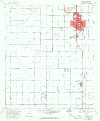
1965 Map of Coolidge
USGS Topo · Published 1966About this map
Casa Grande Ruins National Monument anchors the northern portion of this 1960s survey, preserving the archaeological heritage of the Sonoran Desert. The town of Coolidge sits at a crossroads of irrigation and infrastructure, where the Pima Lateral canal and the Southern Pacific railroad intersect. The map illustrates a landscape transitioned into intensive agriculture, defined by a rigid grid of rural roads like Woodruff Road and Kleck Road that service numerous wells.
Find a feature on this map
47 named features on this map. Tap any name to fly to it.
Don’t see what you’re looking for? This feature index may not catch every label — zoom into the map to look around manually.
Map Details
Editions of this 1965 Coolidge Map
3 editions found
Other maps of this area

1900 · Florence
USGS Topo · 1:125,000

1902 · Florence
USGS Topo · 1:125,000

1907 · Sacaton
USGS Topo · 1:62,500

1922 · Red Rock No 2
USGS Topo · 1:48,000

1922 · Signal Peak
USGS Topo · 1:62,500

1924 · Signal Peak
USGS Topo · 1:62,500

1934 · Newman Peak
USGS Topo · 1:125,000

1954 · Mesa
USGS Topo · 1:250,000

1956 · Tucson
USGS Topo · 1:250,000

1957 · Mesa
USGS Topo · 1:250,000