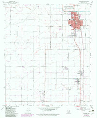
1965 Map of Coolidge
USGS Topo · Published 1983About this map
Casa Grande Ruins National Monument anchors the northern edge of this landscape, preserving the massive Clan House 1 and other archaeological structures alongside a Visitor Center. To the south, the city of Coolidge appears in its mid-century configuration, showing a grid of streets such as Lindbergh Ave and Pima Ave alongside a cluster of local institutions like High Sch and West Sch. The agricultural and institutional character of Pinal County is evident in the presence of the Arizona Children's Colony and the nearby Randolph settlement.
Find a feature on this map
58 named features on this map. Tap any name to fly to it.
Don’t see what you’re looking for? This feature index may not catch every label — zoom into the map to look around manually.
Map Details
Editions of this 1965 Coolidge Map
3 editions found
Other maps of this area

1900 · Florence
USGS Topo · 1:125,000

1902 · Florence
USGS Topo · 1:125,000

1907 · Sacaton
USGS Topo · 1:62,500

1922 · Red Rock No 2
USGS Topo · 1:48,000

1922 · Signal Peak
USGS Topo · 1:62,500

1924 · Signal Peak
USGS Topo · 1:62,500

1934 · Newman Peak
USGS Topo · 1:125,000

1954 · Mesa
USGS Topo · 1:250,000

1956 · Tucson
USGS Topo · 1:250,000

1957 · Mesa
USGS Topo · 1:250,000