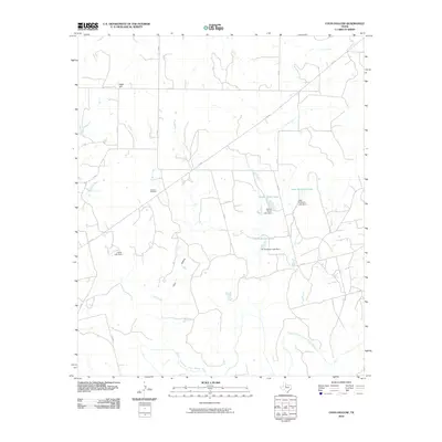
2010 Map of Coon Hollow
USGS Topo · Published 2010About this map
The Double Mountain Fork Brazos River winds through this section of Stonewall County, defining the low-lying southern drainage of a landscape marked by intermittent creeks and cattle tanks. The terrain rises to the north toward Eagle Hill, while the namesake Coon Hollow creates a distinct natural corridor through the center of the quadrangle. This area is characterized by family-named land improvements, notably a series of private reservoirs including Wayne Porter Lake, Leon Anderson Lake, and Jim Anderson Lake, each associated with its own dam. These features, alongside the Johnson Cemetery located off C R 420, provide significant data points for genealogists and local historians tracing the 20th-century ranching and settlement patterns of West Texas. The sparse road network, consisting largely of county roads and FM 610, reflects the enduring rural character of the region.
Find a feature on this map
26 named features on this map. Tap any name to fly to it.
Don’t see what you’re looking for? This feature index may not catch every label — zoom into the map to look around manually.
Map Details
Editions of this 2010 Coon Hollow Map
This is the sole edition of this map. No revisions or reprints were ever made.
Other maps of this area

1893 · Roby
USGS Topo · 1:125,000

1926 · Roby 2-b
USGS Topo · 1:48,000

1931 · Rotan
USGS Topo · 1:62,500

1931 · Aspermont
USGS Topo · 1:62,500

1954 · Lubbock
USGS Topo · 1:250,000

1954 · Big Spring
USGS Topo · 1:250,000

1958 · Big Spring
USGS Topo · 1:250,000
1965 · Hamlin NW
USGS Topo · 1:24,000

1968 · Double Mountains
USGS Topo · 1:24,000
1968 · Aspermont
USGS Topo · 1:24,000