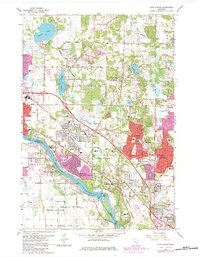
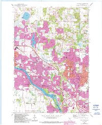
1967 Map of Coon Rapids
USGS Topo · Published 1984About this map
The Mississippi River defines the southwestern boundary of this suburban landscape, where the Coon Rapids Dam and its adjacent Powerhouse sit near Dunn Island. During this era of rapid expansion, residential developments like Thompson Heights and Northdale emerged alongside established community anchors such as Mercy Hospital and Anoka-Ramsey State Junior College. The northern reaches remain punctuated by glacial features like Round Lake, Crooked Lake, and the sprawling wetlands around Coon Creek. Infrastructure for the growing population is evident in the numerous neighborhood schools and the Burlington Northern rail line cutting through the territory. Cultural and civic life is marked by the Radio Tower (WCCO) and several religious sites, including the Morningside Memorial Gardens Cemetery and Epiphany Cem.
Find a feature on this map
65 named features on this map. Tap any name to fly to it.
Don’t see what you’re looking for? This feature index may not catch every label — zoom into the map to look around manually.
Map Details
Editions of this 1967 Coon Rapids Map
5 editions found
Other maps of this area

1902 · White Bear
USGS Topo · 1:62,500

1902 · Anoka
USGS Topo · 1:62,500

1916 · St. Francis
USGS Topo · 1:62,500

1919 · St. Francis
USGS Topo · 1:62,500

1952 · Minneapolis North
USGS Topo · 1:24,000

1952 · New Brighton
USGS Topo · 1:24,000

1953 · Stillwater
USGS Topo · 1:250,000

1955 · Osseo
USGS Topo · 1:24,000

1955 · Circle Pines
USGS Topo · 1:24,000

1955 · Anoka
USGS Topo · 1:24,000