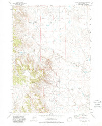
1971 Map of Coon Track Creek
USGS Topo · Published 1988About this map
Halverson Oil Field and the neighboring Reel Oil Field dominate the drainage of the Belle Fourche River system in this corner of Campbell County. The landscape of the early 1970s is characterized by an intensive energy-extraction footprint, where numerous Oil Wells and a network of drill holes are interspersed with ranching features. Key water management for livestock or industry is evident through small impoundments such as Raccoon Reservoir, Brower Reservoir, and Williams Reservoir.
Find a feature on this map
21 named features on this map. Tap any name to fly to it.
Don’t see what you’re looking for? This feature index may not catch every label — zoom into the map to look around manually.
Map Details
Editions of this 1971 Coon Track Creek Map
2 editions found
Other maps of this area

1954 · Gillette
USGS Topo · 1:250,000

1955 · Gillette
USGS Topo · 1:250,000

1958 · Gillette
USGS Topo · 1:250,000

1962 · Gillette
USGS Topo · 1:250,000

1971 · Coyote Draw
USGS Topo · 1:24,000

1971 · Coon Track Creek
USGS Topo · 1:24,000

1971 · Whitetail Creek
USGS Topo · 1:24,000
1971 · Whitetail Creek SE
USGS Topo · 1:24,000

1971 · Rozet
USGS Topo · 1:24,000
1971 · Rozet SE
USGS Topo · 1:24,000