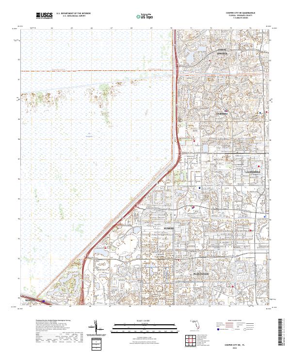
2024 Map of Cooper City NE
USGS Topo · Published 2024About this map
The Everglades dominates the western half of this landscape, partitioned by the Conservation Levee Trl which separates the expansive wetlands from the dense suburban expansion of western Broward County. This 2024 survey captures the intricate boundary where human development meets the protected wilderness, defined by a rigid grid of residential streets and arterial roads like W Sunrise Blvd and Commercial Blvd. The eastern portion of the map is a complex network of incorporated cities including Sunrise, Tamarac, and Plantation, illustrating the modern urbanization of the Florida interior.
Find a feature on this map
25 named features on this map. Tap any name to fly to it.
Don’t see what you’re looking for? This feature index may not catch every label — zoom into the map to look around manually.
Map Details
Editions of this 2024 Cooper City NE Map
This is the sole edition of this map. No revisions or reprints were ever made.
Other maps of this area

1945 · Fort Lauderdale North
USGS Topo · 1:24,000

1946 · West Dixie Bend
USGS Topo · 1:24,000

1949 · Fort Lauderdale North
USGS Topo · 1:24,000

1949 · West Dixie Bend
USGS Topo · 1:24,000

1949 · Fort Lauderdale South
USGS Topo · 1:24,000

1956 · West Palm Beach
USGS Topo · 1:250,000

1957 · West Palm Beach
USGS Topo · 1:250,000

1958 · West Palm Beach
USGS Topo · 1:250,000
1962 · Fort Lauderdale North
USGS Topo · 1:24,000
1962 · West Dixie Bend
USGS Topo · 1:24,000