
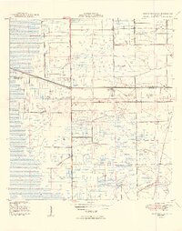
1949 Map of West Dixie Bend
USGS Topo · Published 1949About this map
The Hillsboro Canal cuts a sharp diagonal across this 1949 landscape, marking the engineered boundary between agricultural development and the sawgrass wetlands at the Palm Beach Co Broward Co line. Near the eastern edge, the burgeoning community of Deerfield Beach sits along the Seaboard Air Line railroad, reflecting the post-war growth of coastal Florida. Further inland, the settlement of West Dixie Bend appears amidst a grid of experimental drainage and levee work. This map documents a critical era of land reclamation, where a network of thoroughfares like Range Line Road, Blount Road, and Lyons Road began to define the interior. The numerous Borrow Pits and Levee systems shown are tangible evidence of the massive earthmoving efforts required to transform the Everglades into habitable and productive terrain.
Find a feature on this map
12 named features on this map. Tap any name to fly to it.
Don’t see what you’re looking for? This feature index may not catch every label — zoom into the map to look around manually.
Map Details
Editions of this 1949 West Dixie Bend Map
2 editions found
Other maps of this area

1945 · Fort Lauderdale North
USGS Topo · 1:24,000

1946 · West Dixie Bend
USGS Topo · 1:24,000

1946 · Boca Raton
USGS Topo · 1:24,000

1947 · Delmar Farms
USGS Topo · 1:24,000

1949 · Fort Lauderdale North
USGS Topo · 1:24,000

1949 · Pompano Beach
USGS Topo · 1:24,000

1949 · Delmar Farms
USGS Topo · 1:24,000

1950 · Boca Raton
USGS Topo · 1:24,000

1950 · Delray Beach
USGS Topo · 1:24,000

1956 · West Palm Beach
USGS Topo · 1:250,000