
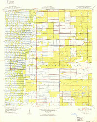
1949 Map of Delmar Farms
USGS Topo · Published 1949About this map
Delmar Farms is depicted here in a transitional period during the late 1940s, showcasing the extensive agricultural drainage and irrigation infrastructure that defined this part of Palm Beach County. The landscape is characterized by a dense grid of canals and a prominent levee system, reflecting the large-scale reclamation efforts of the era. Settlement is sparse, anchored by the small community of Dewitt, situated along the eastern edge of the survey area. Transport and boundary markers, such as Atlantic Avenue and the north-south Range Line, provide the primary orientation for the region. The map captures the specialized land use of the Florida Everglades' edge before the major post-war residential expansion reached this far inland, preserving a view of the area when it was dominated by agricultural enterprise and water management.
Find a feature on this map
5 named features on this map. Tap any name to fly to it.
Don’t see what you’re looking for? This feature index may not catch every label — zoom into the map to look around manually.
Map Details
Editions of this 1949 Delmar Farms Map
2 editions found
Other maps of this area

1945 · Greenacres City
USGS Topo · 1:24,000

1945 · Lake Worth
USGS Topo · 1:24,000

1946 · West Dixie Bend
USGS Topo · 1:24,000

1946 · Boca Raton
USGS Topo · 1:24,000

1947 · Delmar Farms
USGS Topo · 1:24,000

1949 · Lake Worth
USGS Topo · 1:24,000

1949 · West Dixie Bend
USGS Topo · 1:24,000

1950 · Boca Raton
USGS Topo · 1:24,000

1950 · Delray Beach
USGS Topo · 1:24,000

1950 · Greenacres City
USGS Topo · 1:24,000