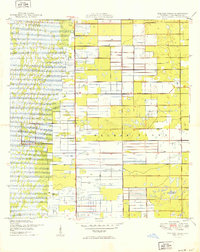
1949 Map of Delmar Farms
USGS Topo · Published 1949About this map
Delmar Farms and the surrounding agricultural landscape of Palm Beach County are captured here just after the war, showing a region defined by a rigid grid of drainage and reclamation. The map illustrates the intensive effort to manage the Florida Everglades, with numerous Levee systems and an extensive network of canals and ditches designed to support large-scale farming operations. Settlement is sparse, with the small community of Dewitt and the corridor along Atlantic Avenue serving as primary landmarks for local navigation. The western portion of the sheet is dominated by marshland and vegetation patterns that contrast sharply with the geometric precision of the engineered agricultural tracts to the east. This 1949 survey provides a clear view of the Range Line and the township and range boundaries that partitioned this part of South Florida before the expansion of suburban development from the coast.
Find a feature on this map
8 named features on this map. Tap any name to fly to it.
Don’t see what you’re looking for? This feature index may not catch every label — zoom into the map to look around manually.
Map Details
Editions of this 1949 Delmar Farms Map
2 editions found
Other maps of this area

1945 · Greenacres City
USGS Topo · 1:24,000

1945 · Lake Worth
USGS Topo · 1:24,000

1946 · West Dixie Bend
USGS Topo · 1:24,000

1946 · Boca Raton
USGS Topo · 1:24,000

1947 · Delmar Farms
USGS Topo · 1:24,000

1949 · Lake Worth
USGS Topo · 1:24,000

1949 · West Dixie Bend
USGS Topo · 1:24,000

1949 · Delmar Farms
USGS Topo · 1:24,000

1950 · Boca Raton
USGS Topo · 1:24,000

1950 · Delray Beach
USGS Topo · 1:24,000