
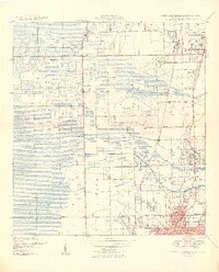
1949 Map of Fort Lauderdale North
USGS Topo · Published 1949About this map
Pompano Canal cuts across the northern reaches of this coastal landscape, illustrating the critical role of drainage and water management in the early development of Broward County. At the end of the 1940s, the region was characterized by a distinct separation between growing urban centers like Fort Lauderdale and Pompano Beach and the agricultural infrastructure to the west. Evidence of the local economy is seen in the Farm Labor Supply Camp and the proximity of the Florida East Coast and Seaboard Air Line railroads, which facilitated the movement of goods and people. The map captures the footprint of essential civic and military services, from the Fort Lauderdale Municipal Airport to the Rifle Range, alongside community landmarks such as Hammondville School and the North Side School. The winding paths of the North Fork Middle River and South Fork Middle River provide a natural contrast to the grid of new roads like Midriver Road and West Dixie Highway.
Find a feature on this map
37 named features on this map. Tap any name to fly to it.
Don’t see what you’re looking for? This feature index may not catch every label — zoom into the map to look around manually.
Map Details
Editions of this 1949 Fort Lauderdale North Map
2 editions found
Other maps of this area

1945 · Fort Lauderdale North
USGS Topo · 1:24,000

1946 · West Dixie Bend
USGS Topo · 1:24,000

1946 · Boca Raton
USGS Topo · 1:24,000

1949 · West Dixie Bend
USGS Topo · 1:24,000

1949 · Port Everglades
USGS Topo · 1:24,000

1949 · Fort Lauderdale South
USGS Topo · 1:24,000

1949 · Pompano Beach
USGS Topo · 1:24,000

1950 · Boca Raton
USGS Topo · 1:24,000

1956 · West Palm Beach
USGS Topo · 1:250,000

1957 · West Palm Beach
USGS Topo · 1:250,000