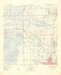
1949 Map of Fort Lauderdale North
USGS Topo · Published 1949About this map
Fort Lauderdale and Pompano Beach appear as developing coastal nodes in this post-war landscape, where the citrus and vegetable economy of South Florida meets early suburban expansion. The survey shows the critical role of water management and transit, with the Pompano Canal and Cypress Creek cutting through the terrain alongside major rail arteries like the Florida East Coast and Seaboard Air Line.
Find a feature on this map
30 named features on this map. Tap any name to fly to it.
Don’t see what you’re looking for? This feature index may not catch every label — zoom into the map to look around manually.
Map Details
Editions of this 1949 Fort Lauderdale North Map
2 editions found
Other maps of this area

1945 · Fort Lauderdale North
USGS Topo · 1:24,000

1946 · West Dixie Bend
USGS Topo · 1:24,000

1946 · Boca Raton
USGS Topo · 1:24,000

1949 · Fort Lauderdale North
USGS Topo · 1:24,000

1949 · West Dixie Bend
USGS Topo · 1:24,000

1949 · Port Everglades
USGS Topo · 1:24,000

1949 · Fort Lauderdale South
USGS Topo · 1:24,000

1949 · Pompano Beach
USGS Topo · 1:24,000

1950 · Boca Raton
USGS Topo · 1:24,000

1956 · West Palm Beach
USGS Topo · 1:250,000