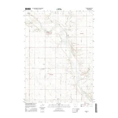
2015 Map of Cooper
USGS Topo · Published 2015About this map
The North Raccoon River carves a winding path through the heart of Greene County, defining the agricultural rhythm of this landscape. Small settlements like Cooper and Winkelmans serve as anchors in a grid of rural roads and county highways, while the southeastern corner of Jefferson appears in the northwest. This 2015 survey reveals a terrain deeply connected to its pioneers, as evidenced by several localized burial grounds, including Saint Marys Cem and Old Rippey Cem. Tributaries such as Buttrick Cr and Dead Brier Cr further divide the fertile fields. Modern recreation is also noted along the Freedom Trl, which follows the river's upper reaches near Jefferson.
Find a feature on this map
55 named features on this map. Tap any name to fly to it.
Don’t see what you’re looking for? This feature index may not catch every label — zoom into the map to look around manually.
Map Details
Editions of this 2015 Cooper Map
This is the sole edition of this map. No revisions or reprints were ever made.
Other maps of this area

1950 · Perry
USGS Topo · 1:62,500

1951 · Perry
USGS Topo · 1:62,500

1951 · Ogden
USGS Topo · 1:62,500

1954 · Bagley
USGS Topo · 1:62,500

1954 · Omaha
USGS Topo · 1:250,000

1954 · Fort Dodge
USGS Topo · 1:250,000

1957 · Omaha
USGS Topo · 1:250,000

1957 · Fort Dodge
USGS Topo · 1:250,000

1958 · Omaha
USGS Topo · 1:250,000

1958 · Fort Dodge
USGS Topo · 1:250,000