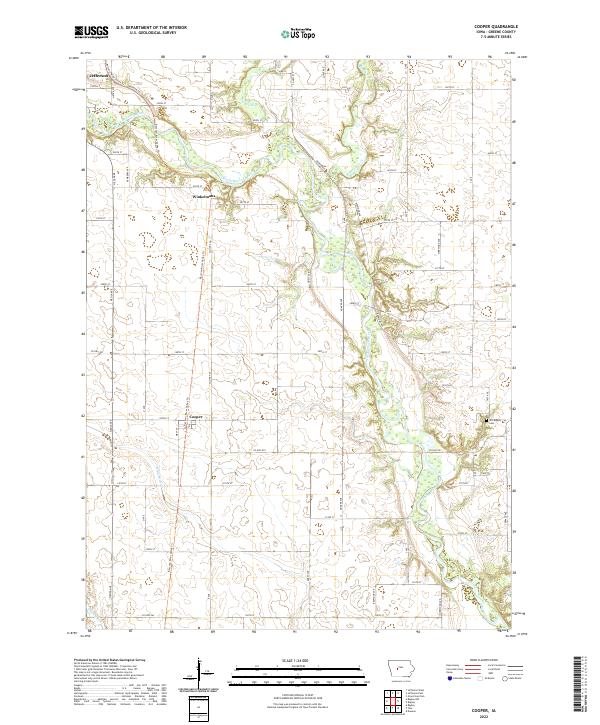
2022 Map of Cooper
USGS Topo · Published 2022About this map
The North Raccoon River carves a winding path through the heart of Greene County, defining the agricultural landscape of this central Iowa region. This modern survey shows the distribution of farmstead tracts and rural infrastructure surrounding the small communities of Jefferson, Winkelmans, and Cooper. The river is joined by several significant tributaries, including Hardin Cr, Buttrick Cr, and Greenbrier Cr, which collectively dictate the local topography and drainage patterns.
Find a feature on this map
15 named features on this map. Tap any name to fly to it.
Don’t see what you’re looking for? This feature index may not catch every label — zoom into the map to look around manually.
Map Details
Editions of this 2022 Cooper Map
This is the sole edition of this map. No revisions or reprints were ever made.
Other maps of this area

1950 · Perry
USGS Topo · 1:62,500

1951 · Perry
USGS Topo · 1:62,500

1951 · Ogden
USGS Topo · 1:62,500

1954 · Bagley
USGS Topo · 1:62,500

1954 · Omaha
USGS Topo · 1:250,000

1954 · Fort Dodge
USGS Topo · 1:250,000

1957 · Omaha
USGS Topo · 1:250,000

1957 · Fort Dodge
USGS Topo · 1:250,000

1958 · Omaha
USGS Topo · 1:250,000

1958 · Fort Dodge
USGS Topo · 1:250,000