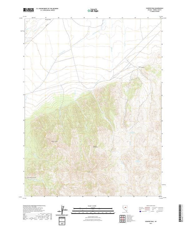
2021 Map of Cooper Peak
USGS Topo · Published 2021About this map
Cooper Peak and Western Peak dominate the high terrain of the Roberts Mountains in this central Nevada landscape. The topography transitions sharply from the rugged peaks of the southern half of the sheet to the broad alluvial reaches of Denay Valley in the north. This high-altitude environment is defined by its drainage systems, where seasonal water sources like Pete Hanson Cr and Birch Cr flow toward the valley floor. Tonkin Rd provides the primary access route through the northern section, connecting the more open terrain with the steeper drainages of Pete Hanson Canyon. For those studying the hydrology of the Great Basin, the presence of isolated water sources such as Lower Dry Creek Spring and Upper Dry Creek Spring indicates the critical points of moisture that support the area's high-desert ecosystem.
Find a feature on this map
24 named features on this map. Tap any name to fly to it.
Don’t see what you’re looking for? This feature index may not catch every label — zoom into the map to look around manually.
Map Details
Editions of this 2021 Cooper Peak Map
This is the sole edition of this map. No revisions or reprints were ever made.
Other maps of this area

1926 · Roberts Mountains
USGS Topo · 1:250,000

1929 · Roberts Mountains
USGS Topo · 1:250,000

1937 · Mineral Hill
USGS Topo · 1:48,000

1943 · Mineral Hill
USGS Topo · 1:62,500

1949 · Garden Valley
USGS Topo · 1:62,500

1949 · Roberts Creek Mtn
USGS Topo · 1:62,500

1951 · Roberts Creek Mtn
USGS Topo · 1:62,500

1951 · Garden Valley
USGS Topo · 1:62,500

1955 · Millett
USGS Topo · 1:250,000

1955 · Winnemucca
USGS Topo · 1:250,000