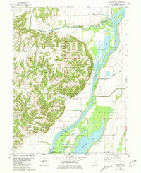
1980 Map of Cooperstown
USGS Topo · Published 1981About this map
The Illinois River corridor dominates this 1980s landscape, serving as a vital artery for the region's river-based economy and environmental preservation. Along the eastern bank, the Meredosia National Wildlife Refuge and Meredosia Lake preserve significant wetland habitats, while the La Grange Lock and Dam facilitates heavy river traffic near La Grange Island. To the west, the terrain rises sharply into the dissected uplands of Spunky Ridge and Cooperstown, where small family-named cemeteries such as Adams Cem and De Witt Cem dot the ridges.
Find a feature on this map
51 named features on this map. Tap any name to fly to it.
Don’t see what you’re looking for? This feature index may not catch every label — zoom into the map to look around manually.
Map Details
Editions of this 1980 Cooperstown Map
This is the sole edition of this map. No revisions or reprints were ever made.
Other maps of this area

1923 · Rushville
USGS Topo · 1:62,500

1926 · Beardstown
USGS Topo · 1:62,500

1926 · Rushville
USGS Topo · 1:62,500

1928 · Meredosia
USGS Topo · 1:62,500

1929 · Arenzville
USGS Topo · 1:62,500

1931 · Meredosia
USGS Topo · 1:62,500

1932 · Arenzville
USGS Topo · 1:62,500

1944 · Beardstown
USGS Topo · 1:62,500

1948 · Quincy
USGS Topo · 1:250,000

1956 · Quincy
USGS Topo · 1:250,000