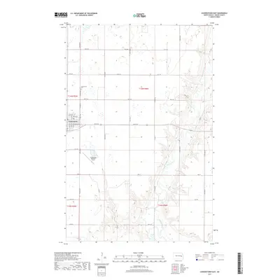
2017 Map of Cooperstown East
USGS Topo · Published 2017About this map
Cooperstown serves as the primary hub of this North Dakota landscape, situated on the western edge of a region defined by the winding course of the Sheyenne River. The river carves a distinct valley through the eastern portion of the map, creating a complex drainage pattern that stands in contrast to the orderly agricultural grid of the surrounding prairie. This township-and-range layout is marked by a network of rural roads such as Co Rd 21 and 114th Ave NE, which connect the town to its outlying lands. Significant local infrastructure is evident in the Cooperstown Municipal Airport to the south and the Cooperstown Cem at the northern edge of town. The transition from the developed streets like Main St and Rollin Ave SE to the erratic bends of the river highlights the intersection of civic planning and the natural topography of Griggs County.
Find a feature on this map
28 named features on this map. Tap any name to fly to it.
Don’t see what you’re looking for? This feature index may not catch every label — zoom into the map to look around manually.
Map Details
Editions of this 2017 Cooperstown East Map
This is the sole edition of this map. No revisions or reprints were ever made.
Other maps of this area

1952 · Grand Forks
USGS Topo · 1:250,000

1952 · New Rockford
USGS Topo · 1:250,000

1956 · New Rockford
USGS Topo · 1:250,000

1956 · Grand Forks
USGS Topo · 1:250,000

1961 · Cooperstown East
USGS Topo · 1:24,000

1961 · Jessie
USGS Topo · 1:24,000

1961 · Hannaford
USGS Topo · 1:24,000

1961 · Cooperstown West
USGS Topo · 1:24,000

1961 · Karnak
USGS Topo · 1:24,000

1966 · Grand Forks
USGS Topo · 1:250,000