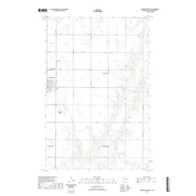
2020 Map of Cooperstown East
USGS Topo · Published 2020About this map
Cooperstown serves as the regional hub in this part of Griggs County, situated on the edge of the glacial plains where the landscape begins its descent toward the Sheyenne River valley. The town layout is clearly defined, anchored by the Griggs County Courthouse and a surrounding grid of residential streets including Park Ave NE and Main St. To the south, the Cooperstown Municipal Airport and its runways mark a significant modern landmark on the outskirts of the settlement. The eastern portion of the map is dominated by the meandering course of the Sheyenne River, which has carved a distinct series of bluffs and ravines into the prairie. Local history is preserved at the Cooperstown Cem and Saint George Cem, which sit just north of the town center near the junction of several county roads.
Find a feature on this map
28 named features on this map. Tap any name to fly to it.
Don’t see what you’re looking for? This feature index may not catch every label — zoom into the map to look around manually.
Map Details
Editions of this 2020 Cooperstown East Map
This is the sole edition of this map. No revisions or reprints were ever made.
Other maps of this area

1952 · Grand Forks
USGS Topo · 1:250,000

1952 · New Rockford
USGS Topo · 1:250,000

1956 · New Rockford
USGS Topo · 1:250,000

1956 · Grand Forks
USGS Topo · 1:250,000

1961 · Cooperstown East
USGS Topo · 1:24,000

1961 · Jessie
USGS Topo · 1:24,000

1961 · Hannaford
USGS Topo · 1:24,000

1961 · Cooperstown West
USGS Topo · 1:24,000

1961 · Karnak
USGS Topo · 1:24,000

1966 · Grand Forks
USGS Topo · 1:250,000