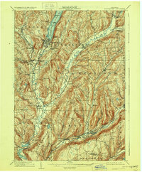
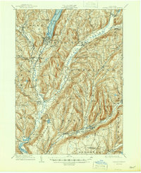
1909 Map of Cooperstown
USGS Topo · Published 1928About this map
Otsego Lake anchors the northern landscape of this region, its southern shore home to the village of Cooperstown. This 1909 survey, reprinted in 1928, illustrates the dense network of early 20th-century settlements and transport corridors in Otsego County. The Susquehanna River flows south from the lake, paralleled by the Cooperstown and Susquehanna Valley RR as it passes through Phoenix Mills and Milford. To the south, the Delaware and Hudson RR follows the Schenevus Creek valley through Schenevus and Maryland. Notable landmarks like the gothic Kingfisher Tower on the lake and the County House west of the river provide specific points of interest for local historians. The map also documents educational and social infrastructure, such as the Hartwick Seminary and various cemeteries including Lakewood Cemetery, reflecting the established community life of the era.
Find a feature on this map
66 named features on this map. Tap any name to fly to it.
Don’t see what you’re looking for? This feature index may not catch every label — zoom into the map to look around manually.
Map Details
Editions of this 1909 Cooperstown Map
6 editions found
Other maps of this area

1898 · Canajoharie
USGS Topo · 1:62,500

1900 · Canajoharie
USGS Topo · 1:62,500

1902 · Canajoharie
USGS Topo · 1:62,500

1903 · Richfield Springs
USGS Topo · 1:62,500

1904 · Richmondville
USGS Topo · 1:62,500

1904 · Hobart
USGS Topo · 1:62,500

1907 · Winfield
USGS Topo · 1:62,500

1907 · Cooperstown
USGS Topo · 1:62,500

1909 · Cooperstown
USGS Topo · 1:62,500

1909 · Delhi
USGS Topo · 1:62,500