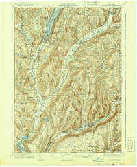
1909 Map of Cooperstown
USGS Topo · Published 1941About this map
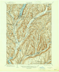
Cooperstown serves as the focal point of this Otsego County survey, situated at the southern tip of Otsego Lake where the Susquehanna River begins its long journey south. The landscape is defined by the steep glacial valleys of Cherry Valley Creek and Schenevus Creek, which carved deep paths through the surrounding highlands. This early 20th-century view captures a network of specialized communities, including Hartwick Seminary and industrial hamlets like Phoenix Mills and Toddsville.
Find a feature on this map
69 named features on this map. Tap any name to fly to it.
Don’t see what you’re looking for? This feature index may not catch every label — zoom into the map to look around manually.
Map Details
Editions of this 1909 Cooperstown Map
6 editions found
Other maps of this area

1898 · Canajoharie
USGS Topo · 1:62,500

1900 · Canajoharie
USGS Topo · 1:62,500

1902 · Canajoharie
USGS Topo · 1:62,500

1903 · Richfield Springs
USGS Topo · 1:62,500

1904 · Richmondville
USGS Topo · 1:62,500

1904 · Hobart
USGS Topo · 1:62,500

1907 · Winfield
USGS Topo · 1:62,500

1907 · Cooperstown
USGS Topo · 1:62,500

1909 · Cooperstown
USGS Topo · 1:62,500

1909 · Delhi
USGS Topo · 1:62,500