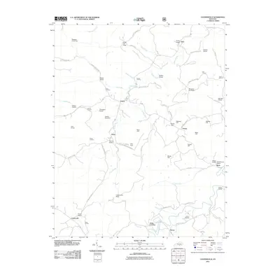
2011 Map of Coopersville
USGS Topo · Published 2011About this map
Keeton Mountain and the Pine Knobs stand over a landscape defined by the winding paths of Sinking Creek and its many tributaries. This 2011 survey of the southern Kentucky uplands reveals a settlement pattern of small, ridge-top communities such as Gregory, Pueblo, and Coopersville, often centered around family names and historical farmsteads. The terrain is marked by numerous vertical features, including Sand Cliff, Washing Cliff, and Tabletop Cliff, which suggest a topography of resistant sandstone benches overlooking deep hollows. Genealogists will find a wealth of local landmarks, from the Kidd Cemetery in the northeast to the Dobbs Cemetery near the southern border. The road network, including routes like Old Big Sink School Rd and Godsey Cemetery Rd, traces the historical movement of residents between these high-ground settlements and the fertile branches below.
Find a feature on this map
80 named features on this map. Tap any name to fly to it.
Don’t see what you’re looking for? This feature index may not catch every label — zoom into the map to look around manually.
Map Details
Editions of this 2011 Coopersville Map
This is the sole edition of this map. No revisions or reprints were ever made.
Other maps of this area

1911 · Monticello
USGS Topo · 1:62,500

1914 · Monticello
USGS Topo · 1:62,500

1932 · Burnside
USGS Topo · 1:62,500

1934 · Barthell
USGS Topo · 1:62,500

1934 · Pall Mall
USGS Topo · 1:62,500

1953 · Frazer
USGS Topo · 1:24,000

1953 · Monticello
USGS Topo · 1:24,000

1953 · Mill Springs
USGS Topo · 1:24,000

1954 · Parmleysville
USGS Topo · 1:24,000

1954 · Coopersville
USGS Topo · 1:24,000