
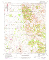
1956 Map of Cooperton
USGS Topo · Published 1959About this map
The settlement of Cooperton serves as the focal point of this mid-century landscape, situated where the open plains meet the northern reaches of the Wichita Mountains. This survey captures a rural environment defined by its transition from agricultural fields to high peaks like Baker Peak and Mount Pinchot. Genealogists will find interest in localized landmarks such as the Springhill Cemetery and Springhill Cemetery Church, along with the Richland Union Church further south.
Find a feature on this map
33 named features on this map. Tap any name to fly to it.
Don’t see what you’re looking for? This feature index may not catch every label — zoom into the map to look around manually.
Map Details
Editions of this 1956 Cooperton Map
2 editions found
Other maps of this area

1937 · Cache
USGS Topo · 1:48,000

1937 · Quanah Mountain
USGS Topo · 1:24,000

1942 · Cache
USGS Topo · 1:62,500

1949 · Cooperton
USGS Topo · 1:62,500

1949 · Quanah Mountain
USGS Topo · 1:24,000

1950 · Snyder
USGS Topo · 1:62,500

1950 · Saddle Mountain
USGS Topo · 1:62,500

1955 · Lawton
USGS Topo · 1:250,000

1956 · Glen Mountains
USGS Topo · 1:24,000

1956 · Saddle Mountain
USGS Topo · 1:24,000