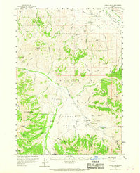
1960 Map of Copper Basin
USGS Topo · Published 1967About this map
Copper Basin Flat serves as the focal point of this 1960 survey, situated between the White Knob Mountains and the Pioneer Mountains. The map illustrates a high-altitude working landscape where ranching and resource extraction coexist within the Salmon National Forest. Evidence of local industry and community infrastructure is concentrated along the Big Lost River and its tributaries, including the Copper Basin Mine, a nearby Smelter, and the Mackay Fish Hatchery. Small-scale cattle operations are visible at the Corral Creek Cow Camp and Rosenkranze Ranch.
Find a feature on this map
89 named features on this map. Tap any name to fly to it.
Don’t see what you’re looking for? This feature index may not catch every label — zoom into the map to look around manually.
Map Details
Editions of this 1960 Copper Basin Map
2 editions found

Other maps of this area

1895 · Hailey
USGS Topo · 1:125,000

1897 · Hailey
USGS Topo · 1:125,000

1929 · Bayhorse
USGS Topo · 1:125,000

1935 · MacKay
USGS Topo · 1:96,000

1935 · Borah Peak
USGS Topo · 1:125,000

1938 · Borah Peak
USGS Topo · 1:125,000

1940 · Mackay
USGS Topo · 1:62,500

1955 · Dubois
USGS Topo · 1:250,000

1955 · Idaho Falls
USGS Topo · 1:250,000

1955 · Hailey
USGS Topo · 1:250,000