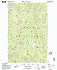
1992 Map of Copper Butte
USGS Topo · Published 1996About this map
Copper Butte and the surrounding peaks of the Kettle River Range dominate this high-elevation landscape within the Colville National Forest. The map documents a critical intersection of historical transport and modern forest management, where the Old Stage Rd follows the high ridges while the Republic Kettle Falls Rd provides lower-elevation passage. The network of unimproved 4-wheel drive roads and trails, such as those reaching Scar Mountain and Lambert Mtn, reflects the area's legacy of mining prospectors and timber access.
Find a feature on this map
26 named features on this map. Tap any name to fly to it.
Don’t see what you’re looking for? This feature index may not catch every label — zoom into the map to look around manually.
Map Details
Editions of this 1992 Copper Butte Map
2 editions found
Other maps of this area

1904 · Republic
USGS Topo · 1:125,000

1936 · Marcus
USGS Topo · 1:96,000

1942 · Marcus
USGS Topo · 1:125,000

1948 · Curlew
USGS Topo · 1:62,500

1948 · Republic
USGS Topo · 1:62,500

1948 · Sherman Peak
USGS Topo · 1:62,500

1948 · Togo Mountain
USGS Topo · 1:62,500

1951 · Togo Mountain
USGS Topo · 1:62,500

1951 · Sherman Peak
USGS Topo · 1:62,500

1951 · Curlew
USGS Topo · 1:62,500