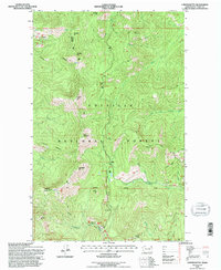
1992 Map of Copper Butte
USGS Topo · Published 1996About this map
Colville National Forest dominates this northern Washington landscape, where high elevations and complex ridgelines define the terrain. The map centers on Copper Butte and Scar Mountain, part of a chain of peaks including Wapaloosie Mtn and Jungle Hill that run through the western half of the quadrangle. A network of forest roads and trails provides access to these summits, which are interspersed with essential water sources like Sherman Creek and the North Fork Deadman Creek.
Find a feature on this map
22 named features on this map. Tap any name to fly to it.
Don’t see what you’re looking for? This feature index may not catch every label — zoom into the map to look around manually.
Map Details
Editions of this 1992 Copper Butte Map
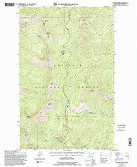
2 editions found
Other maps of this area

1904 · Republic
USGS Topo · 1:125,000

1936 · Marcus
USGS Topo · 1:96,000

1942 · Marcus
USGS Topo · 1:125,000

1948 · Curlew
USGS Topo · 1:62,500

1948 · Republic
USGS Topo · 1:62,500

1948 · Sherman Peak
USGS Topo · 1:62,500

1948 · Togo Mountain
USGS Topo · 1:62,500

1951 · Togo Mountain
USGS Topo · 1:62,500

1951 · Sherman Peak
USGS Topo · 1:62,500

1951 · Curlew
USGS Topo · 1:62,500