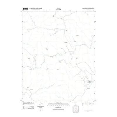
2012 Map of Copper Mountain
USGS Topo · Published 2012About this map
Copper Mountain stands as a central peak in this canyon-carved landscape of western Stanislaus County, where ranching heritage and modern development meet. Long-established family holdings such as Mullally Ranch, Atkins Ranch, and Gerber Ranch are scattered across a complex drainage system defined by Del Puerto Cr and Salado Cr. The terrain is marked by sharp elevation changes, notably through Arkansas Canyon and Slick Rock Canyon, which feed into the larger creek systems. While much of the area remains dedicated to open land and ranching at Ballard Flat and Adobe Flat, the southeastern corner shows the modern residential footprint of Diablo Grande, reached via Diablo Grande Pkwy. These newer road networks contrast with the winding path of Del Puerto Canyon Rd, which traces the natural watercourses through the gulches.
Find a feature on this map
36 named features on this map. Tap any name to fly to it.
Don’t see what you’re looking for? This feature index may not catch every label — zoom into the map to look around manually.
Map Details
Editions of this 2012 Copper Mountain Map
This is the sole edition of this map. No revisions or reprints were ever made.
Other maps of this area

1913 · Romain
USGS Topo · 1:31,680

1915 · Westley
USGS Topo · 1:31,680

1916 · Patterson
USGS Topo · 1:31,680

1916 · Romain
USGS Topo · 1:31,680

1919 · Orestimba
USGS Topo · 1:62,500

1919 · Orestimba Creek
USGS Topo · 1:31,680

1922 · Carbona
USGS Topo · 1:62,500

1938 · Mt. Boardman
USGS Topo · 1:62,500

1941 · Orestimba
USGS Topo · 1:62,500
1941 · Modesto West
USGS Topo · 1:62,500