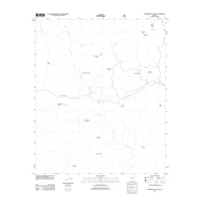
2011 Map of Copperplate Gulch
USGS Topo · Published 2011About this map
Eagle Creek cuts through the heart of this Arizona landscape, carving a complex network of canyons and gulches. The terrain is defined by its industrial and ranching history, with place names like the Coronado Incline and Copper Mountain suggesting the mining heritage of the region, while Seneca Corral points to more traditional land uses. The drainage pattern is dense, featuring significant side-canyons such as Horseshoe Canyon, Stove Canyon, and Trujillo Canyon.
Find a feature on this map
25 named features on this map. Tap any name to fly to it.
Don’t see what you’re looking for? This feature index may not catch every label — zoom into the map to look around manually.
Map Details
Editions of this 2011 Copperplate Gulch Map
This is the sole edition of this map. No revisions or reprints were ever made.
Other maps of this area

1902 · Clifton
USGS Topo · 1:62,500

1913 · Morenci
USGS Topo · 1:125,000

1915 · Morenci
USGS Topo · 1:125,000

1954 · Silver City
USGS Topo · 1:250,000

1954 · Clifton
USGS Topo · 1:250,000

1957 · Clifton
USGS Topo · 1:250,000

1958 · Silver City
USGS Topo · 1:250,000

1958 · Clifton
USGS Topo · 1:250,000

1960 · Guthrie
USGS Topo · 1:62,500

1960 · Safford
USGS Topo · 1:62,500