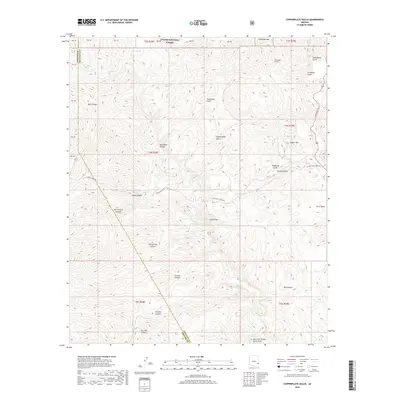
2018 Map of Copperplate Gulch
USGS Topo · Published 2018About this map
Apache National Forest lands dominate this high-desert terrain where the borders of Graham and Greenlee counties meet. The landscape is defined by its drainage systems and mineral-rich topography, evidenced by names like Copper Mtn, Gold Gulch, and Silver Basin. These labels reflect a history of prospecting and resource extraction that shaped the development of eastern Arizona. The map traces the winding course of Eagle Cr and its many tributaries, including South Smith Canyon and Guswert Canyon. Historical land use is further indicated by the Coronado Incline and the famous Coronado Trl, providing a clear picture of the region's infrastructure and geographic challenges. From the thermal waters of Hot Springs to the secluded Garcia Spring, the map documents vital water sources in an arid environment, essential for any study of regional settlement or livestock ranching.
Find a feature on this map
35 named features on this map. Tap any name to fly to it.
Don’t see what you’re looking for? This feature index may not catch every label — zoom into the map to look around manually.
Map Details
Editions of this 2018 Copperplate Gulch Map
This is the sole edition of this map. No revisions or reprints were ever made.
Other maps of this area

1902 · Clifton
USGS Topo · 1:62,500

1913 · Morenci
USGS Topo · 1:125,000

1915 · Morenci
USGS Topo · 1:125,000

1954 · Silver City
USGS Topo · 1:250,000

1954 · Clifton
USGS Topo · 1:250,000

1957 · Clifton
USGS Topo · 1:250,000

1958 · Silver City
USGS Topo · 1:250,000

1958 · Clifton
USGS Topo · 1:250,000

1960 · Guthrie
USGS Topo · 1:62,500

1960 · Safford
USGS Topo · 1:62,500