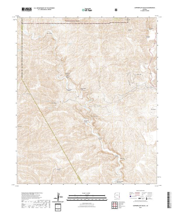
2021 Map of Copperplate Gulch
USGS Topo · Published 2021About this map
Coronado Mtn and Copper Mtn dominate this portion of the Apache National Forest, where the complex topography of Greenlee County is carved by deep drainages and canyons. The perennial waters of Eagle Cr snake through the center of the sheet, supported by numerous seasonal flows and named springs such as Hot Springs and Smith Spring. The map documents a landscape defined by significant elevation changes, notably illustrated by the Coronado Incline and the high ridge of Turtle Mtn. This area has long been shaped by its mineral potential and access, as evidenced by the namesake Copperplate Gulch, Gold Gulch, and Silver Basin. Transport through this vertical terrain is concentrated along the Coronado Trl and the winding Black River Rd, which follow the natural contours of the canyons and gulches.
Find a feature on this map
38 named features on this map. Tap any name to fly to it.
Don’t see what you’re looking for? This feature index may not catch every label — zoom into the map to look around manually.
Map Details
Editions of this 2021 Copperplate Gulch Map
This is the sole edition of this map. No revisions or reprints were ever made.
Other maps of this area

1902 · Clifton
USGS Topo · 1:62,500

1913 · Morenci
USGS Topo · 1:125,000

1915 · Morenci
USGS Topo · 1:125,000

1954 · Silver City
USGS Topo · 1:250,000

1954 · Clifton
USGS Topo · 1:250,000

1957 · Clifton
USGS Topo · 1:250,000

1958 · Silver City
USGS Topo · 1:250,000

1958 · Clifton
USGS Topo · 1:250,000

1960 · Guthrie
USGS Topo · 1:62,500

1960 · Safford
USGS Topo · 1:62,500