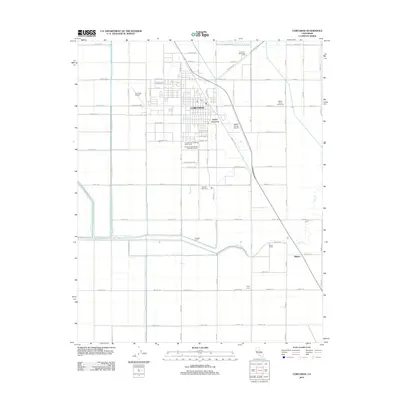
2012 Map of Corcoran
USGS Topo · Published 2012About this map
The agricultural heart of the San Joaquin Valley is anchored by the city of Corcoran and its surrounding worker settlements. This early 21st-century landscape reflects a deeply specialized economy, with large-scale farming infrastructure including the Corcoran High School Agricultural Farm and several named residential sites such as Crockett and Gambogy Labor Camp and Salyer Farms Camp One. The grid of roads, spanning from Newton Ave in the north to Racine Ave in the south, facilitates the movement of goods across this fertile terrain.
Find a feature on this map
66 named features on this map. Tap any name to fly to it.
Don’t see what you’re looking for? This feature index may not catch every label — zoom into the map to look around manually.
Map Details
Editions of this 2012 Corcoran Map
This is the sole edition of this map. No revisions or reprints were ever made.
Other maps of this area

1914 · Lost Hills
USGS Topo · 1:125,000

1927 · Lake View School
USGS Topo · 1:31,680

1927 · Paige
USGS Topo · 1:31,680

1928 · Waukena
USGS Topo · 1:31,680

1928 · Corcoran
USGS Topo · 1:31,680

1929 · Alpaugh
USGS Topo · 1:31,680

1929 · Guernsey
USGS Topo · 1:31,680

1929 · West Alpaugh
USGS Topo · 1:31,680

1931 · Harvester
USGS Topo · 1:31,680

1932 · El Rico Ranch
USGS Topo · 1:31,680