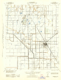
1942 Map of Corcoran
USGS Topo · Published 1942About this map
Corcoran serves as the central hub of this Central Valley landscape, where an intricate network of irrigation infrastructure meets the heavy rail lines of the Atchison Topeka and Santa Fe RR and Southern Pacific RR. The map illustrates a highly managed agricultural environment, defined by a complex grid of canals and ditches including the Peoples Ditch, New Deal Canal, and Guiberson Ditch. The presence of the Corcoran Irrigation District Reservoir and numerous sloughs like Jersey Slough and Cain Slough highlight the critical role of water management in the region's 1940s economy.
Find a feature on this map
71 named features on this map. Tap any name to fly to it.
Don’t see what you’re looking for? This feature index may not catch every label — zoom into the map to look around manually.
Map Details
Editions of this 1942 Corcoran Map
This is the sole edition of this map. No revisions or reprints were ever made.
Other maps of this area

1914 · Lost Hills
USGS Topo · 1:125,000

1926 · Goshen
USGS Topo · 1:31,680

1926 · Hanford
USGS Topo · 1:31,680

1927 · Remnoy
USGS Topo · 1:31,680

1927 · Lake View School
USGS Topo · 1:31,680

1927 · Paige
USGS Topo · 1:31,680

1927 · Lemoore
USGS Topo · 1:31,680

1928 · Waukena
USGS Topo · 1:31,680

1928 · Corcoran
USGS Topo · 1:31,680

1929 · Alpaugh
USGS Topo · 1:31,680