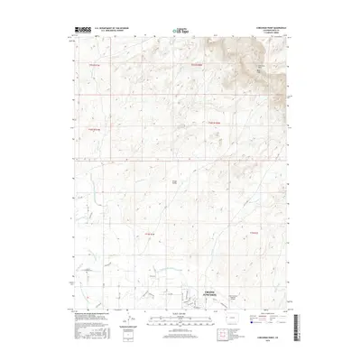
2016 Map of Corcoran Point
USGS Topo · Published 2016About this map
Grand Junction anchors the southeastern corner of this 2016 survey, where the suburban interface meets the expansive landscape of the Grand Valley. The map highlights a sophisticated irrigation network vital to this arid region, including the Main Line Grand Valley Canal and the Government Highline Canal. These man-made waterways cut across natural drainage patterns defined by the Persigo Wash, Hunter Wash, and Leach Cr. To the north, the terrain rises sharply toward the Book Cliffs, dominated by the high promontory of Corcoran Point. This transition from the structured residential blocks near Grand Junction Regional Airport to the wilderness of the cliffs illustrates the area's development constraints and reliance on water engineering. Genealogists and local historians will find interest in Crown Point Cem and the specific road naming conventions that define the rural grid system between the washes.
Find a feature on this map
47 named features on this map. Tap any name to fly to it.
Don’t see what you’re looking for? This feature index may not catch every label — zoom into the map to look around manually.
Map Details
Editions of this 2016 Corcoran Point Map
This is the sole edition of this map. No revisions or reprints were ever made.
Other maps of this area

1929 · Roan Creek
USGS Topo · 1:62,500

1934 · Colorado National Monument
USGS Topo · 1:24,000

1956 · Grand Junction
USGS Topo · 1:250,000

1959 · Grand Junction
USGS Topo · 1:250,000

1960 · Grand Junction
USGS Topo · 1:250,000

1962 · Grand Junction
USGS Topo · 1:250,000

1962 · Fruita
USGS Topo · 1:24,000

1962 · Clifton
USGS Topo · 1:24,000

1962 · Colorado National Monument
USGS Topo · 1:24,000

1962 · Grand Junction
USGS Topo · 1:24,000