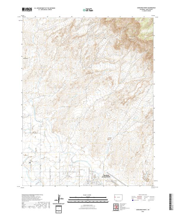
2022 Map of Corcoran Point
USGS Topo · Published 2022About this map
Grand Junction anchors the southeastern corner of this map, showcasing the transition from suburban expansion to the striking terrain of the Grand Valley. The landscape is defined by the impressive Book Cliffs rising to the north and the prominent landmark of Corcoran Point. Essential water management infrastructure, including the Government Highline Canal and the Grand Valley Canal, cut across the valley floor, illustrating the complex irrigation network necessary for local development and agriculture.
Find a feature on this map
51 named features on this map. Tap any name to fly to it.
Don’t see what you’re looking for? This feature index may not catch every label — zoom into the map to look around manually.
Map Details
Editions of this 2022 Corcoran Point Map
This is the sole edition of this map. No revisions or reprints were ever made.
Other maps of this area

1929 · Roan Creek
USGS Topo · 1:62,500

1934 · Colorado National Monument
USGS Topo · 1:24,000

1956 · Grand Junction
USGS Topo · 1:250,000

1959 · Grand Junction
USGS Topo · 1:250,000

1960 · Grand Junction
USGS Topo · 1:250,000

1962 · Grand Junction
USGS Topo · 1:250,000

1962 · Fruita
USGS Topo · 1:24,000

1962 · Clifton
USGS Topo · 1:24,000

1962 · Colorado National Monument
USGS Topo · 1:24,000

1962 · Grand Junction
USGS Topo · 1:24,000