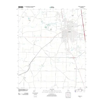
2011 Map of Cordele
USGS Topo · Published 2011About this map
The city of Cordele serves as the focal point of this South Georgia landscape, illustrating a dense grid of streets punctuated by the Cordele Post Office and multiple burial grounds such as Sunnyside Cemetery and Westview Cemetery. The surrounding countryside reveals an economy historically tied to water and milling, with Byrds Mill and Slades Mill situated along the winding paths of Cedar Creek.
Find a feature on this map
65 named features on this map. Tap any name to fly to it.
Don’t see what you’re looking for? This feature index may not catch every label — zoom into the map to look around manually.
Map Details
Editions of this 2011 Cordele Map
This is the sole edition of this map. No revisions or reprints were ever made.
Other maps of this area

1953 · Waycross
USGS Topo · 1:250,000

1957 · Macon
USGS Topo · 1:250,000

1958 · Macon
USGS Topo · 1:250,000

1958 · Waycross
USGS Topo · 1:250,000

1964 · Macon
USGS Topo · 1:250,000

1971 · Pineview SW
USGS Topo · 1:24,000

1972 · Drayton
USGS Topo · 1:24,000
1972 · Vienna
USGS Topo · 1:24,000
1974 · Cordele
USGS Topo · 1:24,000
1977 · Cobb
USGS Topo · 1:24,000