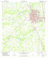
1977 Map of Cordele
USGS Topo · Published 1977About this map
The city of Cordele serves as a significant regional hub in the late 1970s, defined by its intricate grid and the convergence of the Georgia Southern and Florida RR, Seaboard Coast Line, and Georgia Northern railroads. This intersection of rail lines highlights the area's continued importance as a transportation center, supporting local industry and the nearby Cordele Fish Hatchery. The landscape beyond the city limits is characterized by numerous small churches and family burial grounds, such as Macedonia Ch and Slade Cem, reflecting a deeply rooted rural community.
Find a feature on this map
58 named features on this map. Tap any name to fly to it.
Don’t see what you’re looking for? This feature index may not catch every label — zoom into the map to look around manually.
Map Details
Editions of this 1977 Cordele Map
This is the sole edition of this map. No revisions or reprints were ever made.
Other maps of this area

1953 · Waycross
USGS Topo · 1:250,000

1957 · Macon
USGS Topo · 1:250,000

1958 · Macon
USGS Topo · 1:250,000

1958 · Waycross
USGS Topo · 1:250,000

1964 · Macon
USGS Topo · 1:250,000

1971 · Pineview SW
USGS Topo · 1:24,000

1972 · Drayton
USGS Topo · 1:24,000
1972 · Vienna
USGS Topo · 1:24,000
1974 · Cordele
USGS Topo · 1:24,000
1977 · Cobb
USGS Topo · 1:24,000