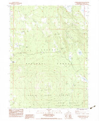
1983 Map of Corders Reservoir
USGS Topo · Published 1983About this map
Lassen National Forest terrain dominates this 1983 survey, revealing a landscape dedicated to timber management, resource extraction, and early pioneer history. The presence of the Eldridge Homestead (Site) and the historic Lassen Trail provides a link to the era of western migration and early settlement in this part of the state. Water management is a primary theme of the geography, with multiple catchments like Corders Reservoir, Busters Reservoir, and Railroad Reservoir scattered among the timber. The map also documents the scientific and conservation footprint of the region through the Blacks Mountain Experimental Forest and the Lassen State Game Refuge. To the south, Blacks Mountain rises as a prominent landmark, while the Old Railroad Grade indicates the historical importance of the logging and transit industries that once operated through these woods.
Find a feature on this map
27 named features on this map. Tap any name to fly to it.
Don’t see what you’re looking for? This feature index may not catch every label — zoom into the map to look around manually.
Map Details
Editions of this 1983 Corders Reservoir Map
2 editions found
Other maps of this area

1886 · Lassen Peak
USGS Topo · 1:250,000

1892 · Lassen Peak
USGS Topo · 1:250,000

1894 · Lassen Peak
USGS Topo · 1:250,000

1939 · Halls Flat
USGS Topo · 1:125,000

1955 · Westwood
USGS Topo · 1:250,000

1956 · Harvey Mtn
USGS Topo · 1:62,500

1957 · Prospect Peak
USGS Topo · 1:62,500

1957 · Little Valley
USGS Topo · 1:62,500

1957 · Jellico
USGS Topo · 1:62,500

1958 · Westwood
USGS Topo · 1:250,000