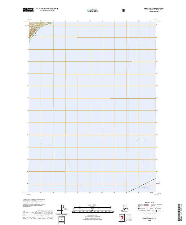
2024 Map of Cordova A-8 NW
USGS Topo · Published 2024About this map
The northwestern coast of Montague Island meets the open waters of the Gulf of Alaska in this maritime-focused survey. Dominated by the protected expanses of the Chugach National Forest in the north and the Alaska Maritime National Wildlife Refuge to the southeast, the landscape is defined by its isolation and lack of human settlement or infrastructure. The coastal environment is marked by significant topographical shifts near the shoreline, where the terrain descends toward the rocky hazards of the sound, including the isolated Seal Rocks. This map illustrates the intersection of federal conservation lands in a remote corner of the state, documenting a shoreline where the wilderness of the island is bounded only by the vast Pacific.
Find a feature on this map
9 named features on this map. Tap any name to fly to it.
Don’t see what you’re looking for? This feature index may not catch every label — zoom into the map to look around manually.
Map Details
Editions of this 2024 Cordova A-8 NW Map
This is the sole edition of this map. No revisions or reprints were ever made.
Other maps of this area

1948 · Cordova
USGS Topo · 1:250,000

1951 · Seward
USGS Topo · 1:250,000

1951 · Cordova
USGS Topo · 1:250,000

1951 · Seward B-1
USGS Topo · 1:63,360

1951 · Seward A-1
USGS Topo · 1:63,360

1951 · Cordova B-8
USGS Topo · 1:63,360
1951 · Cordova A-7 and A-8
USGS Topo · 1:63,360

1952 · Seward B-1
USGS Topo · 1:63,360

1953 · Seward A-1
USGS Topo · 1:63,360
1953 · Cordova B-8
USGS Topo · 1:63,360