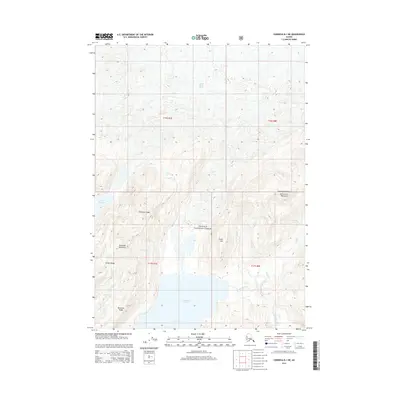
2014 Map of Cordova B-1 NE
USGS Topo · Published 2014About this map
Chugach National Forest encompasses this glacial landscape, dominated by the massive Martin River Glacier in the north and the deep waters of Kushtaka Lake to the south. The terrain is defined by a series of prominent elevations, including Kushtaka Mountain and the expansive Carbon Ridge, which suggest a complex geological environment where ice and water have carved deep drainages. Numerous watercourses such as Stillwater Cr, Penn Cr, and Carbon Cr feed into the primary lake system, illustrating the intricate hydrological network that defines this portion of the Alaskan interior. This mid-2010s survey captures the region’s topography through features like Monument Mountain and Cunningham Ridge, providing a clear record of the watershed and landforms before subsequent environmental shifts.
Find a feature on this map
28 named features on this map. Tap any name to fly to it.
Don’t see what you’re looking for? This feature index may not catch every label — zoom into the map to look around manually.
Map Details
Editions of this 2014 Cordova B-1 NE Map
This is the sole edition of this map. No revisions or reprints were ever made.
Other maps of this area

1948 · Cordova
USGS Topo · 1:250,000

1950 · Bering Glacier
USGS Topo · 1:250,000

1951 · Bering Glacier
USGS Topo · 1:250,000

1951 · Cordova
USGS Topo · 1:250,000

1951 · Cordova B-1
USGS Topo · 1:63,360

1953 · Cordova B-1
USGS Topo · 1:63,360

1959 · Cordova C-1
USGS Topo · 1:63,360

1959 · Bering Glacier
USGS Topo · 1:250,000

1959 · Cordova
USGS Topo · 1:250,000
1985 · Bering Glacier B-8
USGS Topo · 1:63,360