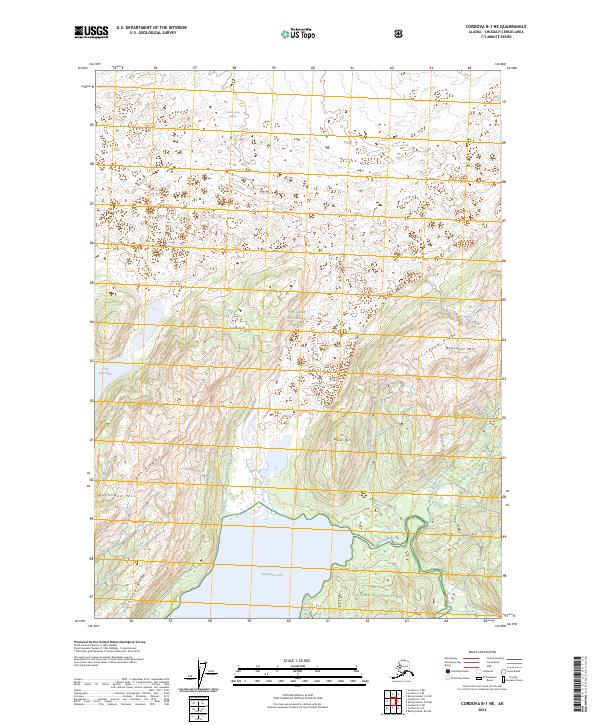
2024 Map of Cordova B-1 NE
USGS Topo · Published 2024About this map
The glacial landscapes of the Chugach National Forest define this area of Alaska, where the Martin River Glacier feeds a complex network of waterways and alpine features. High-altitude landmarks like Kushtaka Mtn and Monument Mtn dominate the horizon, separated by steep divides such as Cunningham Ridge and Charlotte Ridge. This 2024 survey captures the drainage patterns of the Chugach Mountains, showing how meltwater moves through Stillwater Creek and Clear Creek into the significant basin of Kushtaka Lake.
Find a feature on this map
25 named features on this map. Tap any name to fly to it.
Don’t see what you’re looking for? This feature index may not catch every label — zoom into the map to look around manually.
Map Details
Editions of this 2024 Cordova B-1 NE Map
This is the sole edition of this map. No revisions or reprints were ever made.
Other maps of this area

1948 · Cordova
USGS Topo · 1:250,000

1950 · Bering Glacier
USGS Topo · 1:250,000

1951 · Bering Glacier
USGS Topo · 1:250,000

1951 · Cordova
USGS Topo · 1:250,000

1951 · Cordova B-1
USGS Topo · 1:63,360

1953 · Cordova B-1
USGS Topo · 1:63,360

1959 · Cordova C-1
USGS Topo · 1:63,360

1959 · Bering Glacier
USGS Topo · 1:250,000

1959 · Cordova
USGS Topo · 1:250,000
1985 · Bering Glacier B-8
USGS Topo · 1:63,360