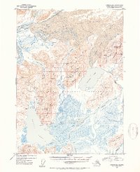
1953 Map of Cordova B-1
USGS Topo · Published 1954About this map
Carbon Camp and several cabin sites represent the sparse human presence in this glacial corridor of the Chugach National Forest during the mid-1950s. The landscape is defined by the massive Martin River Glacier and the drainage systems of the Bering River and Stillwater Creek. To the west, Lake Tokun and Lake Charlotte sit below prominent ridges, while the eastern section is dominated by the expansive Kushtaka Lake and the Shockum Mountains.
Find a feature on this map
46 named features on this map. Tap any name to fly to it.
Don’t see what you’re looking for? This feature index may not catch every label — zoom into the map to look around manually.
Map Details
Editions of this 1953 Cordova B-1 Map
2 editions found
Other maps of this area

1948 · Cordova
USGS Topo · 1:250,000

1950 · Bering Glacier
USGS Topo · 1:250,000

1950 · Cordova B-2
USGS Topo · 1:63,360

1950 · Cordova A-1
USGS Topo · 1:63,360

1950 · Cordova A-2
USGS Topo · 1:63,360

1951 · Bering Glacier
USGS Topo · 1:250,000

1951 · Cordova
USGS Topo · 1:250,000

1951 · Cordova B-1
USGS Topo · 1:63,360

1953 · Cordova A-2
USGS Topo · 1:63,360

1953 · Cordova B-1
USGS Topo · 1:63,360