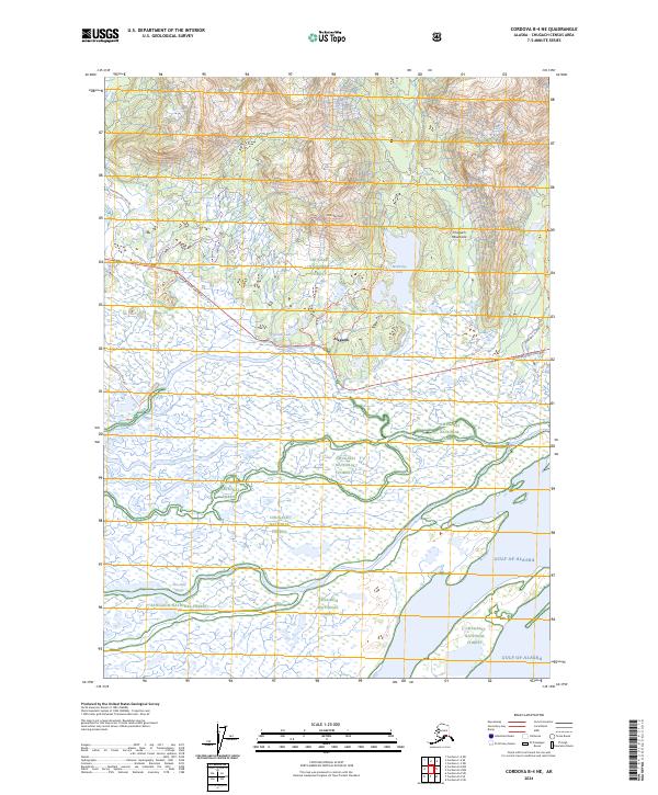
2024 Map of Cordova B-4 NE
USGS Topo · Published 2024About this map
Alaganik sits as a central point of reference where the coastal wetlands meet the rising slopes of the Chugach Mountains. This landscape is defined by the intricate drainage of the Alaganik Slough and Pete Dahl Slough, which weave through the delta towards the Gulf of Alaska. The transition from the aquatic environment of the sloughs and Pipeline Lake to the steep terrain of McKinley Peak is facilitated by a network of trails, including the McKinley Lake Trl and Muskeg Meander Trl. Modern infrastructure like the Copper River Highway follows the natural contours between the mountains and the sea. The map reveals how the Chugach National Forest boundaries encompass both high-altitude peaks and the saturated lowlands of the Copper River Delta, illustrating the geographic diversity of the region.
Find a feature on this map
21 named features on this map. Tap any name to fly to it.
Don’t see what you’re looking for? This feature index may not catch every label — zoom into the map to look around manually.
Map Details
Editions of this 2024 Cordova B-4 NE Map
This is the sole edition of this map. No revisions or reprints were ever made.
Other maps of this area

1948 · Cordova
USGS Topo · 1:250,000

1950 · Cordova C-4
USGS Topo · 1:63,360

1951 · Cordova
USGS Topo · 1:250,000

1951 · Cordova B-4
USGS Topo · 1:63,360

1951 · Cordova C-3
USGS Topo · 1:63,360

1952 · Cordova B-3
USGS Topo · 1:63,360

1953 · Cordova C-3
USGS Topo · 1:63,360

1953 · Cordova C-4
USGS Topo · 1:63,360

1953 · Cordova B-3
USGS Topo · 1:63,360

1959 · Cordova
USGS Topo · 1:250,000