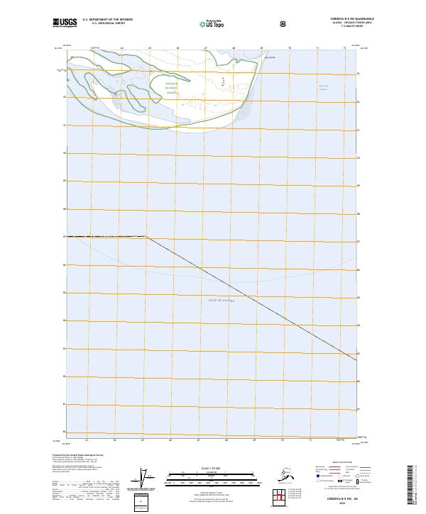
2024 Map of Cordova B-5 SW
USGS Topo · Published 2024About this map
Chugach National Forest territory dominates the northern reaches of this coastal survey, where the terrestrial landscape meets the open waters of the Gulf of Alaska. The environment is defined by the shifting interface of land and sea, most notably the Egg Islands and the tidal pathways of the Egg Island Channel. These features represent the dynamic nature of the Alaskan coastline, where low-lying islands and channels are subject to the constant influence of the Pacific. This 2024 edition provides a contemporary look at the boundary lines of the forest and the natural hydrography of the region, offering a baseline for observing coastal changes in the Chugach Census Area.
Find a feature on this map
6 named features on this map. Tap any name to fly to it.
Don’t see what you’re looking for? This feature index may not catch every label — zoom into the map to look around manually.
Map Details
Editions of this 2024 Cordova B-5 SW Map
This is the sole edition of this map. No revisions or reprints were ever made.
Other maps of this area

1948 · Cordova
USGS Topo · 1:250,000

1951 · Cordova
USGS Topo · 1:250,000

1951 · Cordova B-5
USGS Topo · 1:63,360

1951 · Cordova B-6
USGS Topo · 1:63,360

1953 · Cordova B-5
USGS Topo · 1:63,360

1953 · Cordova B-6
USGS Topo · 1:63,360

1959 · Cordova
USGS Topo · 1:250,000
2000 · Cordova B-5
USGS Topo · 1:63,360
2014 · Cordova B-5 NW
USGS Topo · 1:25,000
2014 · Cordova B-5 NE
USGS Topo · 1:25,000