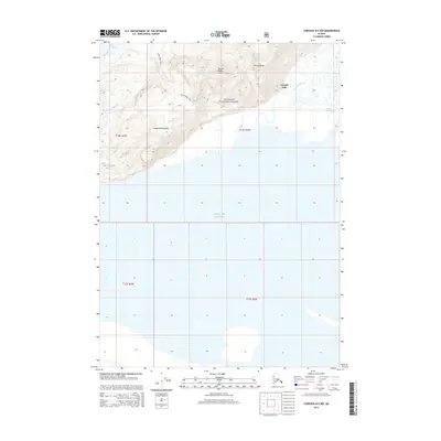
2014 Map of Cordova B-5 NW
USGS Topo · Published 2014About this map
Chugach Mountains rise sharply above the northern reaches of the Gulf of Alaska in this coastal landscape. The terrain is dominated by the steep slopes of the Heney Range and Mount Robert Korn, all contained within the protected boundaries of the Chugach National Forest. Evidence of outdoor navigation and access is marked by the Heney Ridge Trail, which provides a route through the high elevations overlooking the coast. To the east, the transition from mountain to sea is defined by an intricate network of waterways, including Mountain Slough and Center Slough, while Crystal Falls marks a point of descent toward the shoreline. The coastal profile is further shaped by Hartney Bay, providing a clear look at the geological and hydrological intersection of the Alaskan wilderness and the Pacific in the early 21st century.
Find a feature on this map
14 named features on this map. Tap any name to fly to it.
Don’t see what you’re looking for? This feature index may not catch every label — zoom into the map to look around manually.
Map Details
Editions of this 2014 Cordova B-5 NW Map
This is the sole edition of this map. No revisions or reprints were ever made.
Other maps of this area

1948 · Cordova
USGS Topo · 1:250,000

1950 · Cordova C-6
USGS Topo · 1:63,360

1951 · Cordova
USGS Topo · 1:250,000

1951 · Cordova C-5
USGS Topo · 1:63,360

1951 · Cordova B-5
USGS Topo · 1:63,360

1951 · Cordova B-6
USGS Topo · 1:63,360

1953 · Cordova C-6
USGS Topo · 1:63,360

1953 · Cordova B-5
USGS Topo · 1:63,360

1953 · Cordova C-5
USGS Topo · 1:63,360

1953 · Cordova B-6
USGS Topo · 1:63,360