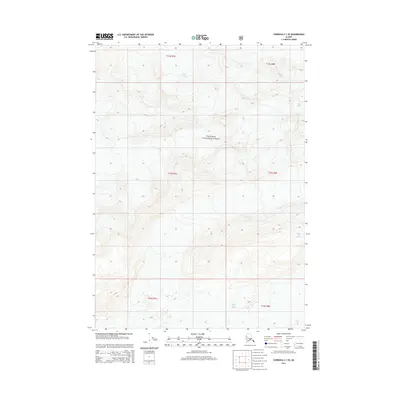
2014 Map of Cordova C-1 SE
USGS Topo · Published 2014About this map
Chugach National Forest encompasses the entirety of this high-altitude landscape in the Unorganized Borough, where massive ice fields and glacial movements define the local geography. The northern edge of the sheet is dominated by the terminus and outwash of the Miles Glacier, while the southeastern corner is shaped by the sprawling Martin River Glacier. Between these two ice masses, the map records a wilderness of steep contour gradients and drainage patterns, unmarred by roads or permanent settlements. The presence of these active glaciers highlights the dynamic nature of the Southcentral Alaska coastline, where ice and rock are the primary architects of the terrain.
Find a feature on this map
9 named features on this map. Tap any name to fly to it.
Don’t see what you’re looking for? This feature index may not catch every label — zoom into the map to look around manually.
Map Details
Editions of this 2014 Cordova C-1 SE Map
This is the sole edition of this map. No revisions or reprints were ever made.
Other maps of this area

1948 · Cordova
USGS Topo · 1:250,000

1950 · Bering Glacier
USGS Topo · 1:250,000

1951 · Bering Glacier
USGS Topo · 1:250,000

1951 · Cordova
USGS Topo · 1:250,000

1951 · Cordova B-1
USGS Topo · 1:63,360

1953 · Cordova B-1
USGS Topo · 1:63,360

1959 · Cordova C-1
USGS Topo · 1:63,360

1959 · Bering Glacier
USGS Topo · 1:250,000

1959 · Cordova
USGS Topo · 1:250,000
1985 · Bering Glacier B-8
USGS Topo · 1:63,360