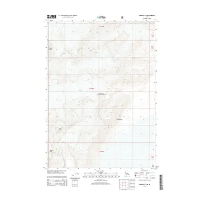
2014 Map of Cordova C-3 SW
USGS Topo · Published 2014About this map
Meakerville sits along the southern edge of this glaciated landscape, serving as a localized point of settlement within the expansive Chugach National Forest. The geography is defined by significant ice fields and towering summits, including the massive Goodwin Glacier to the north and the Sherman Glacier flowing from the west. These glacial systems carve through the terrain surrounding peaks such as Mount Murchison and Shattered Peak. The drainage patterns and topographic contours reveal a dynamic environment where alpine ice meets the coastal influence of the Unorganized Borough. South of the larger peaks, Saddlebag Glacier and Pyramid Peak overlook the lower elevations leading toward Long Island, illustrating the transition from high mountain summits to the water-dominated features of the Alaskan coast.
Find a feature on this map
16 named features on this map. Tap any name to fly to it.
Don’t see what you’re looking for? This feature index may not catch every label — zoom into the map to look around manually.
Map Details
Editions of this 2014 Cordova C-3 SW Map
This is the sole edition of this map. No revisions or reprints were ever made.
Other maps of this area

1948 · Cordova
USGS Topo · 1:250,000

1950 · Cordova C-4
USGS Topo · 1:63,360

1951 · Cordova
USGS Topo · 1:250,000

1951 · Cordova B-4
USGS Topo · 1:63,360

1951 · Cordova C-3
USGS Topo · 1:63,360

1952 · Cordova B-3
USGS Topo · 1:63,360

1953 · Cordova C-3
USGS Topo · 1:63,360

1953 · Cordova C-4
USGS Topo · 1:63,360

1953 · Cordova B-3
USGS Topo · 1:63,360

1959 · Cordova
USGS Topo · 1:250,000