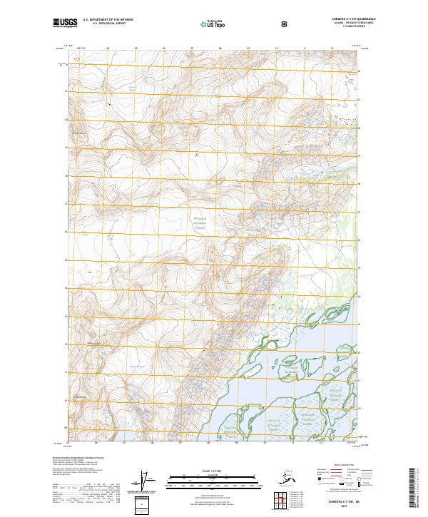
2024 Map of Cordova C-3 SW
USGS Topo · Published 2024About this map
Glacial ice dominates the high-altitude landscape of this part of the Chugach National Forest, where massive frozen rivers carve through the Chugach Mountains. Notable ice masses like the Sheridan Glacier and Sherman Glacier descend from the peaks, their movement and historical extent being primary drivers of the local topography. This modern survey illustrates the current boundaries of several smaller alpine glaciers, including the Goodwin Glacier, Fickett Glacier, and Saddlebag Glacier, which are critical for studying environmental changes over the last several decades.
Find a feature on this map
16 named features on this map. Tap any name to fly to it.
Don’t see what you’re looking for? This feature index may not catch every label — zoom into the map to look around manually.
Map Details
Editions of this 2024 Cordova C-3 SW Map
This is the sole edition of this map. No revisions or reprints were ever made.
Other maps of this area

1948 · Cordova
USGS Topo · 1:250,000

1950 · Cordova C-4
USGS Topo · 1:63,360

1951 · Cordova
USGS Topo · 1:250,000

1951 · Cordova B-4
USGS Topo · 1:63,360

1951 · Cordova C-3
USGS Topo · 1:63,360

1952 · Cordova B-3
USGS Topo · 1:63,360

1953 · Cordova C-3
USGS Topo · 1:63,360

1953 · Cordova C-4
USGS Topo · 1:63,360

1953 · Cordova B-3
USGS Topo · 1:63,360

1959 · Cordova
USGS Topo · 1:250,000